Welcome to SDR
Mapping Solutions for 9-1-1 and Public Safety
Mailing Address: P.O. Box 684, Olathe, KS 66051
Spatial Data Research is a GIS mapping, software and consulting company specializing in integrating GPS with our mapping and GIS applications. Since incorporating in 1993, SDR has provided E9-1-1 mapping, addressing and communications services, along with custom software development and GIS consulting, to more than 300 counties, municipalities and private sector clients.
Since our incorporation in 1993, SDR has completed more than three hundred GIS/mapping projects for state, county, municipal, public safety and private sector clients. The following projects are representative of our wide range of experience and diverse client base.
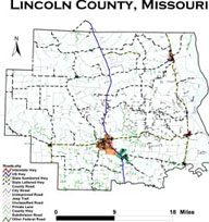
- Lincoln County, Missouri/E-911
- New Mexico/Texas PSAP Boundary Edge Matching Project
- Escambia County, AL GIS Enhancement to Improve "Reverse911"
- Larimer County Multi-Agency Readdressing Project
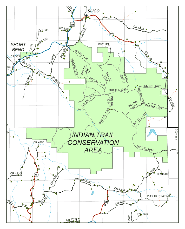
- To'hajiilee Chapter/Navajo Nation/E9-1-1 Pilot Project
- Dent County Rural Addressing Project
- City of Van Alstyne Readdressing and GIS Services
|
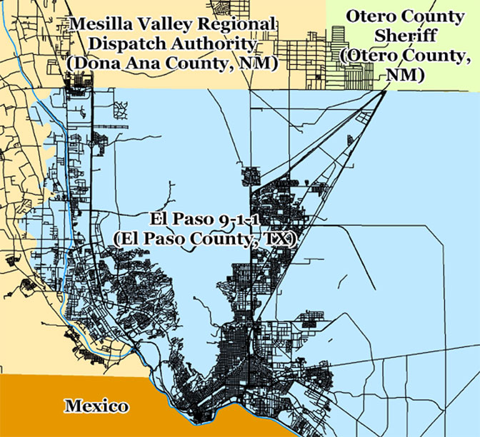
New Mexico/Texas PSAP Boundary Edge Matching Project |
|
The need to compile and maintain regionalized GIS layers for multi-agency use becomes more critical as the E9-1-1 industry moves to Next Generation 9-1-1. NG9-1-1 is based on IP networks delivering communication from text messages to video to traditional 9-1-1 calls to Public Safety Answering Points across the country. Key to determining call and message routing are GIS boundaries defining PSAPs, Emergency Service Zones and Communities. As 9-1-1 calls will be routed spatially in NG9-1-1 environments, accurate PSAP boundaries in GIS format are required for accurate call routing. The State of Texas approached the State of New Mexico in 2009 to enter a joint project to resolve PSAP boundaries at the state line which extends from the Oklahoma Panhandle to the El Paso area. SDR, as the State of New Mexico’s E9-1-1 GIS Consultant, is working with more than 25 PSAPs and the two states to adjust New Mexico’s GIS PSAP boundaries as a critical first step to implementing geospatial call routing in New Mexico and Texas. |
 |
GIS Enhancement to Improve "Reverse911" Escambia County, AL GIS Enhancement to Improve "Reverse911" |
|
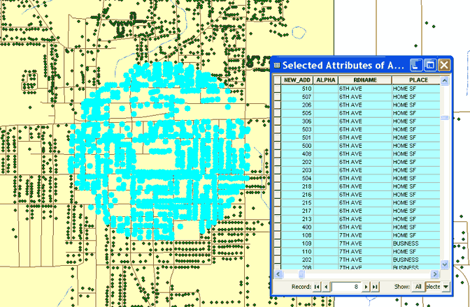
Escambia County is located just north of the Pensacola, Florida metro area. This rural but populous Alabama County has a home-grown GIS and addressing system and previous to this project was using ArcView 3.2 to maintain its data. A move by the county to purchase an emergency notification system required an extensive scrub of addressing and telephone databases and revealed some weaknesses in the GIS and the need for mapped address points to add geospatial depth to “Reverse 9-1-1” emergency notification system. SDR worked with Escambia County on a project to GPS the locations of every addressed structure in the county and synchronize E9-1-1 and GIS databases to enhance dispatch call mapping and improve the effectiveness of Reverse 9-1-1. The project paved the way for Next Generation 9-1-1 Ready GIS data for Escambia County and integrated MSAG data directly into the GIS. (click image to see larger map) |
 |
Multi-Agency Readdressing Project Larimer County Multi-Agency Readdressing Project |
|
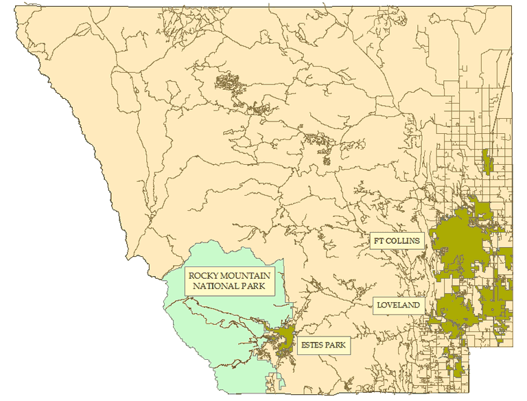
SDR worked SDR was chosen by Larimer County, Colorado, home to Ft. Collins and Rocky Mountain National Park, to implement a multi-year comprehensive readdressing project so that all rural addressing follows the adopted County Addressing Ordinance. The project involved not only GIS enhancement, GPS field data location and readdressing, but also involved building standard operating procedures and establishing processes with local and regional post offices, all county agencies using the addressing, the 9-1-1 database provider and private and public utilities. Each rural address in this county of nearly 300,000 residents was examined and verified in this project. The impact to citizens having to change addresses was weighed against the benefits of a logical, county-wide addressing system and dozens of town meetings and Q&A meetings were organized and held by SDR and SDR’s professional public relations consultant to educate the public and respond to their concerns. The project covered five well-planned stages spanning over six years. (click image to see larger map) |
 |
|
To'hajiilee Chapter/Navajo Nation/E9-1-1 Pilot Project |
|
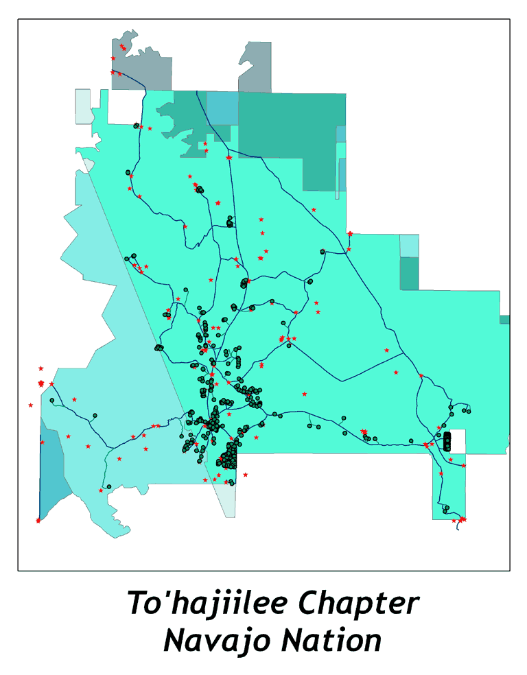
SDR worked with the To’hajiilee Chapter of the Navajo Nation, Bernalillo County, NM and the New Mexico E9-1-1 Program to complete this first of its kind Rural Addressing/E9-1-1 Project on the Navajo Nation. The To’hajiilee Chapter is located primarily in Bernalillo County, about an hour west of Albuquerque, and is not contiguous with the rest of the Navajo Nation. The project consisted of ground-up GIS, rural addressing assignment, in-field address notification and data collection and 9-1-1 database creation, all in an effort to improve E9-1-1 service for chapter members. This successful pilot project served as a proving ground for unique project methodologies crafted for future E9-1-1 work with New Mexico’s more than 50 Navajo Nation chapters. As of 2009, members of the To’hajiilee Chapter enjoy fully enhanced landline and wireless 9-1-1 services and benefit from permanent physical addressing as well. (click image to see larger map) |
 |
|
Dent County, Missouri |
|
Residents in the Missouri County of Dent, just southeast of Rolla on the I-44 Corridor, have not yet passed a sales tax or landline telephone surcharge to fund Enhanced 9-1-1 in the county. Thus, rural residents did not have physical addresses, as most rural addressing projects go hand in hand with E9-1-1 projects. However, Dent County’s Commissioners recognized the ever-increasing need for addressing. Residents unable to provide physical addresses had difficulty getting driver’s licenses, cable TV service, package delivery services and even gun permits. In a proactive move, the County’s Commissioners decided to fund a Rural Addressing/GIS project from the general fund and contracted with SDR for the project. More than 5,000 rural residents were addressed in the county and the local post offices participated fully in the project, most welcoming the new addresses for mail delivery so they could benefit from the USPS’ automated sorting services. The County also cleaned up and expanded its road numbering system during the project and sponsored the creation of a historic sites GIS layer to contain historic cemeteries and Dent County’s portion of the Trial of Tears. In another unique and proactive move, the County employed the University Extension Service to maintain GIS and addressing for the county’s rural residents. The Extension Service uses SDR’s AddressIt software along with real-time GPS in its GIS/Addressing maintenance activities. (click image to see larger map) |
 |
|
City of Van Alstyne, Texas |
|
| Van Alstyne, Texas is located 30 miles north of Dallas. The city is experiencing rapid growth but has limited staffing. The city was historically addressed over the years using four different addressing schemes which made it very difficult for Emergency Providers to locate an address during an emergency. Before readdressing, it was not uncommon to find four address ranges with odd and even numbers on both sides of the street. The City Council recognized the liability of inconsistent addressing and contracted with SDR to provide comprehensive, logical addressing and to build and improve key GIS layers including boundaries, address points, driveways, road centerlines and fire hydrants. SDR retained as many of the old addresses as possible, built a new address city block style scheme, completed the project in six months and is now maintaining the addressing and GIS data until Van Alstyne has the resources to hire a GIS position within the City. The Police, Fire and City Hall Departments can now view their City GIS layers with aerial photos utilizing SDR’s Go2It software. Van Alstyne, Texas is the first small City in Grayson , Texas to prepare their City for the GIS demands of Next Generation 911. (click image to see larger map) | 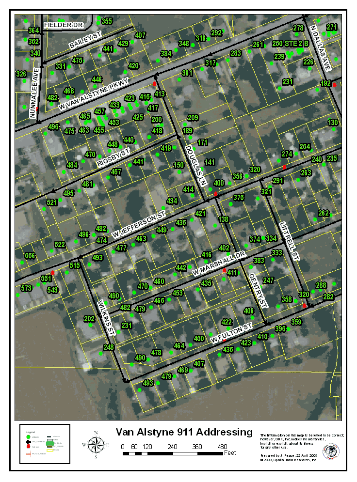 |
| Mapping, Addressing, and GIS for E-911 |
|
|
Lincoln
County, Missouri SDR completed the original mapping and addressing in 1996, using differential GPS in the field and MicroStation as the mapping platform. The County successfully maintained the system for five years using GPS to map new roads and homes and SDR's custom software to automate digital mapping and addressing. In 2001, with newer and better GIS and GPS tools available, SDR helped Lincoln County migrate their data into ArcView. Today, Lincoln County uses SDR's ASIA addressing and Tao GPS interface software with real time GPS to update its 9-1-1 GPS in one integrated field process. Lincoln County also uses Go2It. SDR's map location software, interfaced to the existing 9-1-1 and CAD software for immediate call mapping. SDR has completed full-service E9-1-1 projects like Lincoln County's in more than 50 U.S. counties. |
 |
Andrea Rice - SDR Customer
“We’ve used Spatial Data Research (SDR) for the last 10 years and have nothing but positive things to say about the company and their products. The Go2It program is extremely easy to use and more than efficient for our needs. SDR’s technical support team is phenomenal! They are courteous and always willing and able to solve any problems or answer any questions we have. We couldn’t ask for a better product or group of people to work with!”
Andrea Rice
911/Emergency Management
Osage County, Missouri
Rod Neal - SDR Customer
"Since March of 2004 Spatial Data Research has provided mapping solutions for Ottawa County, Oklahoma E9-1-1. SDR delivers hardware and service in a timely manner and continues to provide prompt professional support with our occasional questions. SDR keeps us informed of the latest innovations in mapping and we look forward to continuing our business relationship."
Rod Neal
Ottawa County 9-1-1 Coordinator
Ottawa County, Oklahoma